Windows
Mac
Windows
Log in / Sign up
Windows
›
Tags › topographic map
Most popular
Topographic Map
software
Relevance
Popularity
Rating
CompeGPS AIR
135
CompeGPS TEAM S.L.
CompeGPS AIR enables users to create and edit flight routes...
to any kind of
maps
such as opographic, vector
Florida Topo Map
free
75
GPSFileDepot
Features: - Roads - Interstates, highways...
to create a detailed
topographic
map
...24k detail. This
map
is created for Garmin
TOPO! Explorer
free
62
National Geographic Maps
TOPO! Explorer is a free desktop application created by National Geographic Maps...
contains freely browsable
topographic
maps
, aerial imagery...and print detailed
maps
, plus connect
SINMAP
free
56
Utah State University
SINMAP (Stability Index MAPping) is an ArcView extension that implements the computation and mapping...
the computation and
mapping
of a slope...) obtained from a
topographically
New Mexico Topo Map
free
38
GPSFileDepot
The purpose of this venture is to create a detailed topographic map...
to create a detailed
topographic
map
...24k detail. This
map
is created for Garmin
OZtopo
30
Oztopo
OZtopo provides an alternative set of maps, suitable for use on Garmin GPS units. It has been designed...
detailed set of
topographical
maps
suitable for bushwalking...any of Garmin's
mapping
products, eg
TopoMapCreator
free
19
K. King
TopoMapCreator includes 5 programs: ExtendedMapCreator allows you to create "Topographic Maps" from OSM...
helps creating
topographic
maps
. It consists...for creating
Topographic
Maps
, GeoToolsCmd provides
Moagu
17
Moagu
Moagu: The Mother Of All GPS Utilities. You can convert USGS topographic maps...
You can convert USGS
topographic
maps
, aerial/satellite imagery...GPS units. Garmin
maps
BG Road Maps
16
Omni Resources
This map combines topographic mapping...
This
map
combines
topographic
mapping
...altitude shading. The
map
shows six
MapToaster Topo/NZ
11
Integrated Mapping Ltd
MapToaster Topo New Zealand is New Zealand's only topographical mapping suite...
New Zealand's only
topographical
mapping
suite ...includes Topo50 and Topo250
map
series. 1
Ozi Map Grabber
free
11
Jackaroo_4WD
Ozi Map Grabber is a free program that downloads maps (or a series of maps)...
that downloads
maps
(or a series of
maps
)...won't make you
topographic
maps
, but will do decent
MapSource - US Topo
10
Garmin Ltd or its subsidiaries
Plan your next outdoor adventure with the help of MapSource United States TOPO...
application contains digital
topographic
maps
for the U.S...000-scale paper
maps
. See the product
SiroVision
free
10
Datamine
Sirovision is a geology / geotechnical mapping and analysis system that generates accurate...
geology / geotechnical
mapping
...structure. Quickly
map
structure
Landformer Pro
free
6
Geomantics
GenesisIV's landscape definition tools have always been a strong feature of the system and we get many requests to make...
landscapes from scratch using
topographic
maps
- Import data from graphics
WW2D
free
5
Vitaliy Pronkin
WW2D allows you to explore Earth using satellite imagery, topographic maps...
Earth using satellite imagery,
topographic
maps
and image
MapList
free
4
MapList
The utility MapList is created for simplifying the work with the topographic maps in OziExplorer...
work with the
topographic
maps
in OziExplorer...of the scanned
topographic
maps
can
QuickSurf for AutoCAD 2009
2
PetroByte LLC
QuickSurf is a fast, powerful general purpose surface modeling system running...
geologic
mapping
and exploration, surveying, photogrammetry and
topographic
mapping
, landscape
CyclingPeaks Crs+
1
CyclingPeaks
You don't need an altimeter, a GPS unit, nor topographical mapping software to quickly...
altimeter, a GPS unit, nor
topographical
mapping
software to quickly create
RDF Calculator
free
1
Wolfgang Buescher, DL4YHF.
The RDF Calculator was primarily written for radio-direction finding. RDF Calculator for radio-direction finding...
direction finding,
topographic
map
display, locator calculation...of a 'live'
map
for Spectrum Lab's
NavPak Pro & MapSetup
Global Navigation Software Co
NavPak is a full featured GPS navigation program, available in Professional and Lite editions for PC computers...
digital charts, and USGS
Topographical
maps
, or scan...own charts and
maps
. It is compatible
1
2
Tags
Topographic
Maps
Map
GPS
Software
Satellite
Topographic maps
Explorer
STATE
Mapping
Featured stories
See all
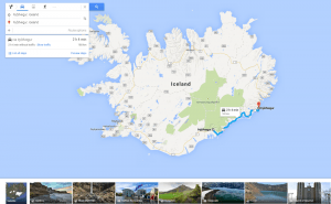
More Opportunities For Trips With Google Maps
Google Maps has recently released a new set of features that will definitely improve user traveling experience.
Mind Mapping Tools: Not To Lose Bright Ideas
Here goes a list of mind mapping tools that will surely help visual thinkers avoid half-concepts and patchy schemes while brainstorming.
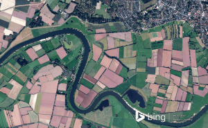
New Bing Maps Preview Focuses On Travelling Plans
Bing Maps Preview has just been updated with a few features that make planning your trips much more convenient.
Halo 5's map editor is now available for free in Windows 10
Unfortunately, Microsoft didn't give us any official information about when or if the game itself will be coming to Windows 10.
Draw on Windows Maps
The default Maps app that Windows offers gives you some very handy drawing options. Here's everything that you need to know about it.